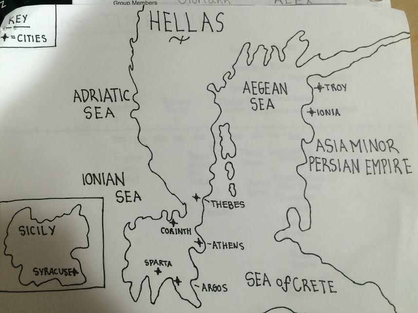
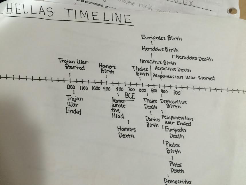
Greek Mini Map Timeline
The purpose of creating the mini map timeline was to have a smaller map by your side so when the class would be taking notes you would have a visual of the different cities, routes, and times the Trojans and Greeks lived in. The map needed to be hand drawn of the older version of Greece and show how it looked back then when it was known has Hellas. The students needed to make sure that the map had all the main cities of Hellas, the Asia Minor, Persian Empire, Sicily, and all the main seas surrounding land. To show organization there should have been a compass and key to help navigate the map. The timeline needed to have the correct dates starting from 1200 BCE to 300 BCE. It needed to have all the birth and death dates of the famous wars, philosophers, and poets.
When creating this map timeline I learned that I need to be exact with the dates and that the hand drawn piece needed to be an accurate image of what Greece looked like back then. I had made some mistakes the first time I created it because my map wasn't accurate to where all the cities of Greece were placed. I learned that I should have found amore accurate images and sites to make sure that my information and sketches weren't inaccurate. When creating a map it needs to be easy to use, the user needs to be able to know where certain cities are and if your using symbols to represent a certain place or thing, you need to make sure that you have a key/legend. My first draft I've forgotten to add a key so when the critiquing came it was marked as a "confusing" map. I learned form all the mistakes I've done to make something better, it taught me that things need to be exact in order to make something work. You need to have all the pieces to the puzzle.
When creating this map timeline I learned that I need to be exact with the dates and that the hand drawn piece needed to be an accurate image of what Greece looked like back then. I had made some mistakes the first time I created it because my map wasn't accurate to where all the cities of Greece were placed. I learned that I should have found amore accurate images and sites to make sure that my information and sketches weren't inaccurate. When creating a map it needs to be easy to use, the user needs to be able to know where certain cities are and if your using symbols to represent a certain place or thing, you need to make sure that you have a key/legend. My first draft I've forgotten to add a key so when the critiquing came it was marked as a "confusing" map. I learned form all the mistakes I've done to make something better, it taught me that things need to be exact in order to make something work. You need to have all the pieces to the puzzle.